


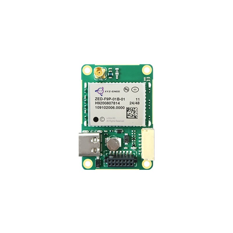
From metre-level to centimetre-level, and what actually has to change to get there
A GPS module for high precision GNSS is often specified by the accuracy number alone, which is the least useful way to choose one. Metre-level, decimetre-level, and centimetre-level positioning are produced by different techniques, require different correction sources, and depend on different antenna arrangements. A module that reaches two centimetres with RTK corrections will fall back to metres when those corrections stop, and a product team that did not plan for that behaviour will ship a device that behaves unpredictably in the field.
This guide explains the accuracy tiers available today, why a GPS-only receiver cannot reach centimetre level on its own, how multi-frequency and multi-constellation reception change the picture, and how to select a module based on the application rather than on the datasheet headline.
The Accuracy Tiers and What Produces Each One
Four tiers are commonly quoted, and each corresponds to a different technique rather than to a different quality of hardware.
| Tier | Technique | Dependency |
|---|---|---|
| Metre level | Single point positioning | Nothing beyond a clear sky view |
| Sub-metre | SBAS or DGNSS corrections | Regional augmentation service |
| Decimetre level | PPP convergence | Precise orbit and clock products |
| Centimetre level | RTK or PPP-RTK | Base station or network corrections |
The hardware requirement rises with each tier, but not in the way most buyers expect. The receiver does not become dramatically more sensitive; it gains the ability to measure carrier phase, to process multiple frequencies, and to apply corrections. A high-precision module in single-point mode is not more accurate than an ordinary module. It only becomes more accurate when the corrections and the antenna support it.
Why a GPS-Only Receiver Cannot Reach Centimetre Level
The name GPS is often used generically, but a module that tracks only the GPS constellation on L1 has three structural limits. It has fewer satellites available, so geometry is weaker and the fix is fragile in obstructed environments. It has only one frequency, so it cannot correct the ionospheric delay that dominates single-frequency error. And it has limited redundancy, so a single satellite outage affects the solution more.
A GPS module for high precision GNSS, in practice, tracks multiple constellations and at least two frequencies. BDS, GPS, GLONASS, Galileo, and QZSS together provide far more satellites than GPS alone, and a second frequency allows the ionospheric delay to be estimated directly instead of modelled. That combination is what makes fast, reliable ambiguity resolution possible.
For buyers, this means the specification to examine is the frequency and constellation matrix, not the product name. A module labelled as GPS that supports L1, L2, and L5 across five constellations is a high-precision engine. A module labelled as GNSS that supports L1 only across three constellations is not.
The Antenna Is Half of the Accuracy
Module specifications assume an antenna that delivers a clean signal. In practice, antenna choice limits performance more often than the receiver does.
- Band coverage. If the antenna does not cover L5, the module cannot use it. Multiplying the receiver's capability by the antenna's bandwidth is the first check in any high-precision design.
- Phase centre stability. RTK measures carrier phase at the antenna's phase centre. If that point moves with temperature or elevation, the solution moves with it, and no amount of receiver processing can recover the lost accuracy.
- Ground plane. A patch antenna without an adequate plane radiates backwards, receives multipath from below, and detunes. The plane is part of the antenna, not an accessory.
- Cable and connector loss. Every decibel lost between antenna and receiver reduces the signal-to-noise ratio the module has to work with, which slows ambiguity resolution and reduces availability in marginal conditions.
Choosing the Correction Strategy
The correction source often determines the product architecture more than the module does.
A local base station gives the best accuracy over short baselines and full control over availability, at the cost of hardware, a monument, and a radio link. A network RTK service removes the base station but depends on cellular coverage and on the network operator's continuity. PPP requires no local infrastructure but needs a convergence period, which suits applications that operate continuously rather than starting and stopping. PPP-RTK combines the two, offering faster convergence than PPP while removing the base station.
Each option imposes a requirement on the module: the ability to accept RTCM corrections in the right format, to handle a network mount point, or to process SSR corrections. Confirm that the module's firmware supports the correction type before the hardware design is fixed, because adding it later may mean a different part.
Bandwidth is the constraint that is usually discovered late. A network RTK stream carrying every constellation at full rate can exceed the capacity of a narrowband radio link, so the module must accept a reduced message set without losing the fixed solution. In practice this means checking which message types the module can process independently, and testing the behaviour on a link that delivers only the subset your infrastructure can actually carry.
Matching the Module to the Application
Selection checklist
- Which accuracy tier does the application genuinely require, and what happens below it?
- What correction source is available at the deployment site, and in what format?
- Does the antenna cover every band the module can use?
- How quickly must the solution converge after start-up or obstruction?
- What interface does the host processor provide, and is a timing signal needed?
- Does the module report accuracy honestly when corrections are lost?
A consumer tracker, a survey rover, and a machine control system all need different answers to those questions, and the same module rarely serves all three well. The most expensive mistake in this category is buying more accuracy than the correction infrastructure can deliver, because the product then carries the cost of a high-precision engine without ever achieving high-precision results.
Yonghao Innovation GPS and GNSS Module Range
Yonghao Innovation Tech is a national high-tech enterprise established in 2014, based in Shenzhen, Guangdong, China. We integrate research, manufacturing, and sales, and we supply GNSS satellite antennas, positioning terminals, data communication products, and customized high-precision BeiDou solutions for surveying and monitoring, aerospace, communication time service, autonomous driving, machine control, and intelligent transportation.
Our GPS module range covers both general positioning and high-precision work. The AD56UB8 is a BeiDou and GPS professional positioning module for products that need reliable positioning without RTK infrastructure. Where centimetre accuracy is required, the RTK GNSS module family provides multi-frequency, multi-constellation engines.
For compact products that cannot accommodate a separate antenna and cable, the YM-450Q integrates the antenna with the module, which removes the connector loss and the ground plane uncertainty that a separate antenna introduces. Complete terminals built around these engines are listed under GPS receiver, and our technical support team can review correction-source compatibility for your region.
Conclusion
Selecting a GPS module for high precision GNSS is a systems decision, not a component decision. The accuracy tier determines the technique, the technique determines the correction source, and the correction source determines what the product must carry. Once those are settled, the module choice narrows quickly to parts whose constellation and frequency support, correction format, and quality reporting match the design. Starting from the datasheet accuracy figure instead usually leads to a product that is expensive and still not accurate where it matters.
Tell us your target accuracy, correction source, and host interface, and we will narrow the module choice for you.
Define my accuracy target See RTK module optionsFrequently Asked Questions
Q1: Can a GPS module for high precision GNSS work without corrections?
It can operate in single-point mode, but the accuracy falls back to metre level. High precision requires either RTK corrections from a base or network, or PPP corrections from a service. Without them, the module's extra capability is not used.
Q2: Which bands does a GPS module for high precision GNSS need?
At minimum two frequencies, typically L1 plus L2 or L5, so that ionospheric delay can be estimated rather than modelled. Supporting L2 and L5 together improves availability and shortens convergence, particularly where satellite visibility is limited.
Q3: Does a GPS module for high precision GNSS need a special antenna?
Yes. The antenna must cover every band the module uses and must have a stable phase centre, because RTK measures phase at that point. A wideband antenna with an adequate ground plane matters as much as the receiver specification.
Q4: How long does a GPS module for high precision GNSS take to converge?
RTK typically converges in seconds when the baseline is short and the sky is open, and takes longer in obstructed conditions. PPP normally requires minutes. If the application cannot tolerate either delay at start-up, a design that maintains a warm state or uses a network service with faster convergence is preferable.
Q5: What should a GPS module for high precision GNSS report when accuracy degrades?
It should report the solution type and an accuracy estimate that changes as conditions change, rather than keeping a fixed flag. Downstream software needs that information to decide whether to trust the position, blend it with other sensors, or alert the user.